Near Record Heat at Disney World Goes Out With A Bang
An approaching cold front is going to end the recent record-breaking temperatures across Central Florida. Get the details on thunderstorm timing and the severe threat for Disney World.
Weather Forecast Discussion

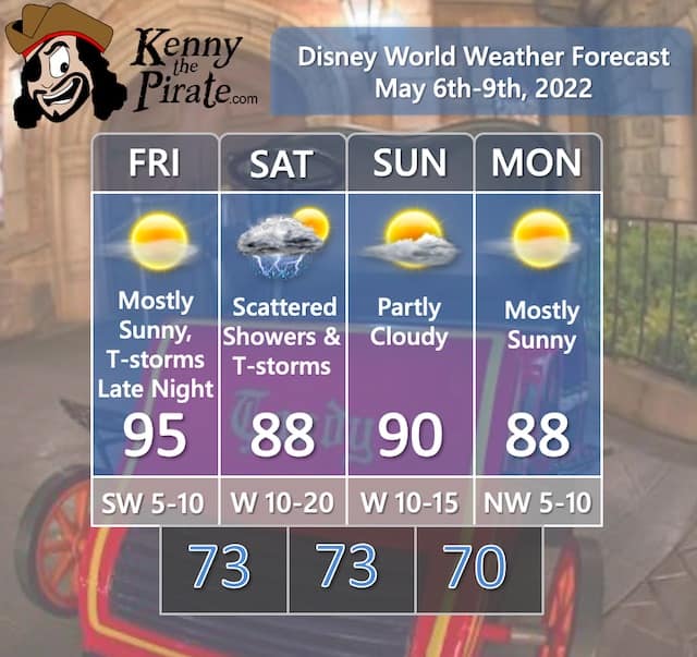
Near record highs are possible once again on Friday as a large area of high pressure remains in control of our weather. It has been a hot week, and on Thursday Orlando International Airport tied a record high of 95 degrees.
The record heat will come to an end at the hands of a cold front approaching from the northwest. Showers and thunderstorms are possible late Friday night through Saturday morning. We should see some clearing by later in the day Saturday. I'll have more on the thunderstorm threat below.
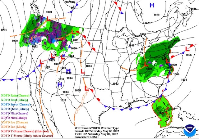
On the image above you can see the front approaching early Saturday morning with showers and thunderstorms ahead of it.
The front will meander near the area the rest of the weekend but will lose its moisture, passing through Central Florida with little fanfare. Temperatures will be a little cooler than the recent record highs, and it will be less humid for a few days.
Severe Weather Chances For Florida
On the map below you can see that Orlando is included in the "Marginal Risk" for severe thunderstorms for overnight Friday night. For Saturday morning it is the same category as well. I do believe we could see a few storms meet severe criteria across the area as the front meets the moist, hot airmass ahead of it.
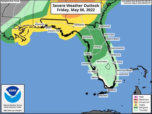
Remember that any thunderstorm can produce gusty winds, frequent lightning, and heavy downpours. Follow any warnings and cast member directions to take shelter.
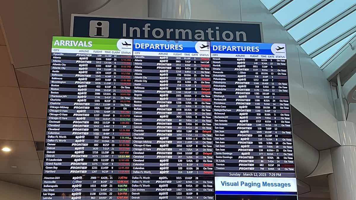
Flight Impacts

This category is designed to point out any large-scale impacts on flights getting to and from Orlando. The struggles and impacts on the airline industry in the wake of the pandemic that led to flight cancellations have been well-documented. I'm focusing on the weather impacts.
The main weather feature that could affect flights will be a developing Nor'easter off the Mid Atlantic coast. This system could bring delays to the airports in the Mid Atlantic and Northeast U.S. Be sure to check on your flight status if you are traveling to/from this region on Friday and Saturday.
In terms of Orlando-area airports, we could see delays Saturday morning as showers and thunderstorms move through Central Florida. Improving conditions are expected by later Saturday.
A Look Ahead

Looking ahead to next week, I'll be keeping an eye on low pressure off the VA/NC coast. Computer models are split on how close this low will be to the Florida coast. This low could bring some shower chances next week with temperatures in the mid to upper 80's. Changes with that low track will greatly affect next week's forecast so stay tuned!
Are you headed to Disney World this weekend? Will the showers affect your plans? Are you happy the record heat is ending? Let us know in the comments below or on Facebook!