Is There Tropical Trouble For Disney World This Weekend?
June 1st marks the official start of the Atlantic Hurricane Season, and we already have our first system to watch this weekend. Get the details on what to expect in Disney World.
Hurricane Tracking Begins

Last week we had an update on NOAA's 2022 Seasonal Hurricane Outlook which called for an above average season. So far it looks like that will be the case as we already have a disturbance to monitor on the 1st day of the season. Let's take a look at what to expect from this system.
The National Hurricane Center is monitoring a system that is currently over the Yucatan Peninsula in Mexico. As you can see from the graphic below, the NHC gives this system a high chance of development over the next few days. You can see the system is expected to approach Florida from the southwest, as the red shaded area shows the expected general movement.
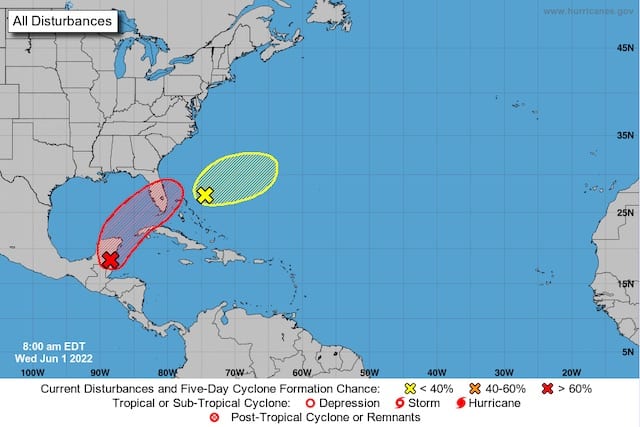
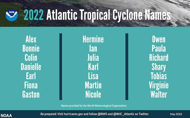
If this does indeed become a Tropical Depression, the NHC will begin to issue more specific track information that we are accustomed to seeing. Should this disturbance develop into a Tropical Storm, the first name used this season will be Alex. Coincidentally, this system is actually the remnants of Agatha, which was the first Hurricane in the Eastern Pacific this season.
Potential Impacts
Any impacts from this system as of now will be on Friday night and Saturday in the Orlando area. Leading up to that day we will have our normal hot weather with chances of showers and thunderstorms.
To be clear, the biggest threat from this system will likely be the heavy rain. At this point this system is not expected to be a wind concern in Central Florida (or even the coastal areas at this point). The track of the potential system, however, is still very much up in the air.
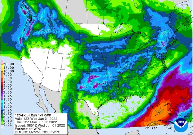
Looking at the QPF (amount of precipitation) map below you can see right now Orlando is on the northern fringes of the heaviest rain, with South Floria projected to receive much more rain. We are not out of the woods just yet. A few computer models, such as the European (ECMWF) have a further north track that would bring Orlando into more of the heavy rain. On the contrary, the GFS has a much further track to the south making this almost a non-story for Orlando.
Bottom Line
A key piece to remember right now is that the system is still over the Yucatan Peninsula. Models have a tough time with where to place the low as it emerges into the Gulf of Mexico. Things should become more clear over the next couple of days. With that said, in my opinion I do expect Orlando to see a period of heavy rain Friday night and/or early Saturday, but the heaviest will be off to the south. I'll fine tune my thinking in the next update.
I would not cancel any plans, but rather this is just something to monitor for where the heavy rain band will set up. Keep an eye on this system as it could alter the schedule of special events such as Typhoon Lagoon's H2O Glow on Saturday. Let's hope the system struggles to develop as it emerges from the Yucatan Peninsula.

What do you think about this system? Do you have plans for Saturday in Disney World? Let us know in the comments below or on Facebook!